
History-Collectors.com
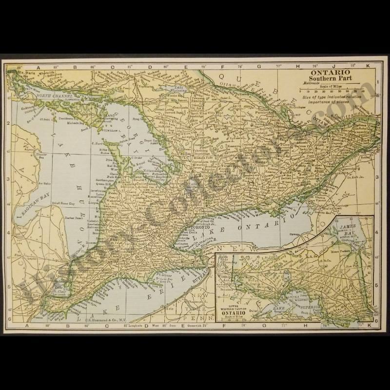
1929 Southern Ontario Canada Geography Map - C.S. Hammond And Company New York - Great Lakes Basin - Railroad Lines - Roaring Twenties Era - Ready For Framing
1929 Southern Ontario Canada Geography Map - C.S. Hammond And Company New York - Great Lakes Basin - Railroad Lines - Roaring Twenties Era - Ready For Framing
Couldn't load pickup availability
Vintage Original 1929 Southern Ontario Canada Geography Map - C.S. Hammond And Company New York - Great Lakes Basin - Railroad Lines - Roaring Twenties Era - Ready For Framing
This 1929 Cartographic Reference Of Southern Ontario, Published By C.S. Hammond & Co., Provides An Architectural View Of The Canadian Transport Corridor During The Interwar Period. The Document Delineates The Geographic Proximity Between The Great Lakes Basin—Specifically Lake Huron, Lake Erie, And Lake Ontario—And The Bordering Regions Of Michigan, New York, And Quebec. Central Focus Is Placed On The Dense Network Of Railroad Lines Interconnecting Major Settlement Hubs Such As Toronto, Hamilton, London, And Windsor, While The Integrated Inset Map Documents The Remote Rail Links Extending Toward Lake Superior, James Bay, And The Western Gateway Of Winnipeg. This Primary Source Captures The Industrial Expansion Of The Golden Horseshoe And Southwestern Ontario, Offering A Precise Snapshot Of The Maritime And Terrestrial Infrastructure Defining The Region’s Late 1920s Economic Landscape.
In Very Good Vintage Condition – Trimmed Edges, Toning Due To Age And History-Collectors Watermarked That Is Not On The Map. Measures Approx. 7-1/8" Wide by 5-1/8" Tall.
Product Photos Include A Watermark And Possibly An Object For Scale / Photography Purposes Only. Also, Product Listings May Include Newspaper Images, Display Photos Or Short Video Clips Relevant To The Item Which Are Not Included In The Purchase. The Product Title Is For The Exact Item Available.
Share