
History-Collectors.com
1929 Alaska Territory Map - Maritime Trade - Industrial Railroad Routes - Roaring Twenties Era - Ready For Framing
1929 Alaska Territory Map - Maritime Trade - Industrial Railroad Routes - Roaring Twenties Era - Ready For Framing
Couldn't load pickup availability
Vintage Original 1929 Alaska Territory Map - Maritime Trade - Industrial Railroad Routes - Roaring Twenties Era - Ready For Framing
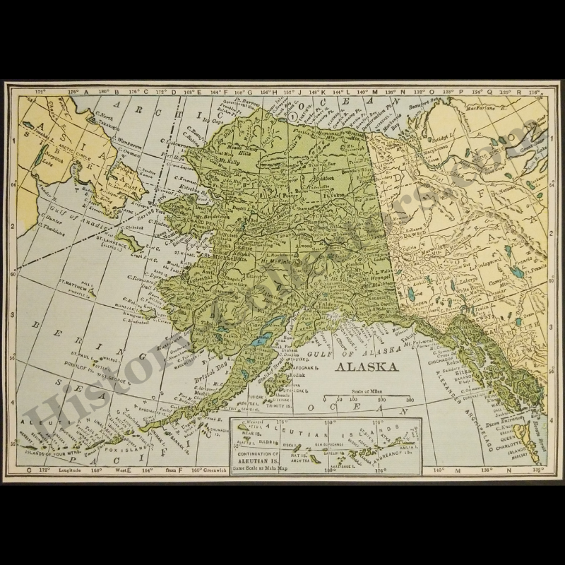
This Cartographic Representation Of The 1929 Territory Of Alaska Documents A Pivotal Era Of American Territorial Expansion And Industrial Development In The Early Twentieth Century. Published Prior To Statehood, This Map Illustrates The Established Infrastructure Of The Alaska Railroad And Vital Maritime Trade Routes Connecting The Seward Peninsula To Continental North America. It Details Crucial Geographical Landmarks Including Mount McKinley, The Yukon River Basin, And The Aleutian Archipelago During A Period Defined By Large-Scale Gold Mining Operations And The Emergence Of Bush Pilot Aviation. This Primary Source Serves As A Historical Record Of Arctic Topography, International Boundaries With The Russian Far East And British Columbia, And Colonial Naming Conventions Of The Interwar Period.
In Very Good Vintage Condition – Trimmed Edges, Toning Due To Age And History-Collectors Watermarked That Is Not On The Map. Measures Approx. 7-1/8" Wide by 5-1/8" Tall.
Product Photos Include A Watermark And Possibly An Object For Scale / Photography Purposes Only. Also, Product Listings May Include Newspaper Images, Display Photos Or Short Video Clips Relevant To The Item Which Are Not Included In The Purchase. The Product Title Is For The Exact Item Available.
Share