
History-Collectors.com
1929 Bulgaria Geography Map - C.S. Hammond And Company New York - New Brunswick - Interwar Post-WWI Period - Treaty of Neuilly-sur-Seine - Roaring Twenties Era - Ready For Framing
1929 Bulgaria Geography Map - C.S. Hammond And Company New York - New Brunswick - Interwar Post-WWI Period - Treaty of Neuilly-sur-Seine - Roaring Twenties Era - Ready For Framing
Couldn't load pickup availability
Vintage Original 1929 Bulgaria Geography Map - C.S. Hammond And Company New York - New Brunswick - Interwar Post-WWI Period - Treaty of Neuilly-sur-Seine - Roaring Twenties Era - Ready For Framing
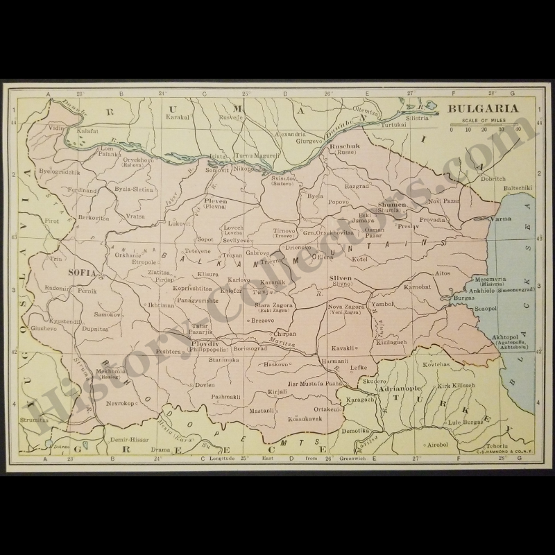
This 1929 Political Map Of Bulgaria Published By C.S. Hammond & Co. Serves As A Primary Cartographic Record Of The Kingdom Of Bulgaria During The Interwar Period. This Specific Rendering Illustrates The Territorial Boundaries Defined By The 1919 Treaty Of Neuilly-Sur-Seine, Which Formally Ended Bulgaria's Participation In World War I And Resulted In The Loss Of Western Thrace To Greece. The Document Details Regional Infrastructure And Major Urban Centers Including Sofia, Plovdiv (Philippopolis), And Ruschuk, While Demarcating Borders With Yugoslavia, Rumania, And Turkey. Produced In New York, This American-Lithographed Map Provides Historical Geopolitical Context Regarding The Post-War Balkan Settlement And The Geographic Consolidation Of The Third Bulgarian State Prior To The Territorial Revisions Of World War II.
In Very Good Vintage Condition – Trimmed Edges, Toning Due To Age And History-Collectors Watermarked That Is Not On The Map. Measures Approx. 7-1/8" Wide by 5-1/8" Tall.
Product Photos Include A Watermark And Possibly An Object For Scale / Photography Purposes Only. Also, Product Listings May Include Newspaper Images, Display Photos Or Short Video Clips Relevant To The Item Which Are Not Included In The Purchase. The Product Title Is For The Exact Item Available.
Share