
History-Collectors.com
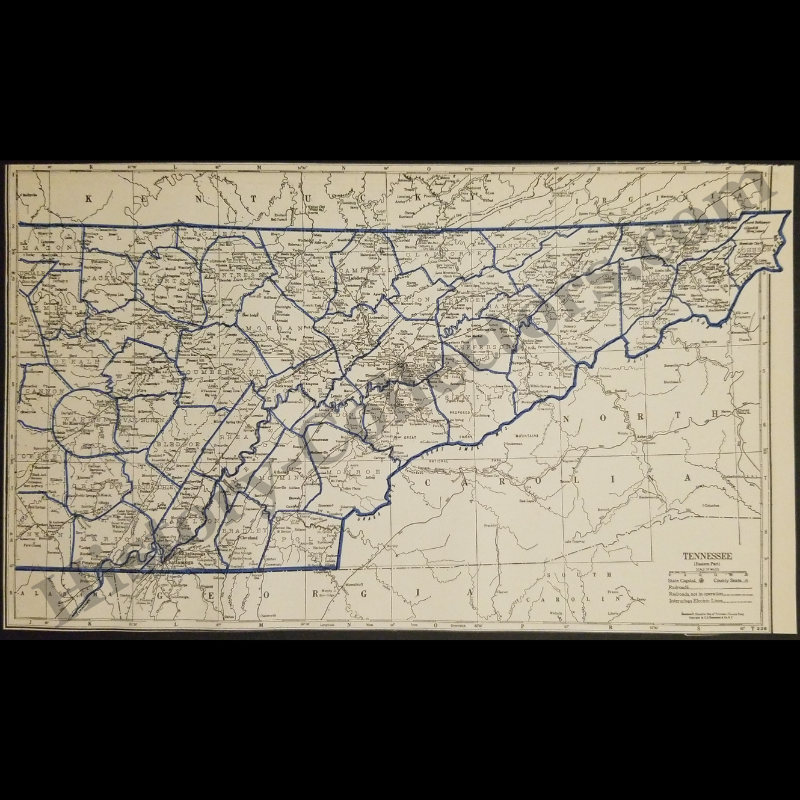
1929 Eastern Tennessee Map - Railroad Lines - Interurban Electric Systems - Roaring Twenties Era - Ready For Framing
1929 Eastern Tennessee Map - Railroad Lines - Interurban Electric Systems - Roaring Twenties Era - Ready For Framing
Couldn't load pickup availability
Vintage Original 1929 Eastern Tennessee Map - Railroad Lines - Interurban Electric Systems - Roaring Twenties Era - Ready For Framing
This Detailed 1929 George F. Cram Company Map Of Eastern Tennessee Documents The Region’s Transportation Infrastructure During The Pre-Depression Industrial Expansion. The Cartography Highlights Operating Railroads, Proposed Lines, And Interurban Electric Systems That Connected Appalachian Hubs Like Knoxville And Chattanooga. Published By The Indianapolis-Based Firm, This Map Features Precise County Boundaries And Early Topographical References To The Great Smoky Mountains Prior To National Park Status. It Serves As A Primary Source For The Evolution Of Southern Commercial Networks And Historical Cartography In The Early Twentieth Century.
In Very Good Vintage Condition – Trimmed Edges, Toning Due To Age And History-Collectors Watermarked That Is Not On The Map. Measures Approx. 8-1/4" Wide by 4-7/8" Tall.
Product Photos Include A Watermark And Possibly An Object For Scale / Photography Purposes Only. Also, Product Listings May Include Newspaper Images, Display Photos Or Short Video Clips Relevant To The Item Which Are Not Included In The Purchase. The Product Title Is For The Exact Item Available.
Share