History-Collectors.com
1929 Forth And Clyde Junction Railway Tourism Routes Scotland Sketch Map Print Clipping - London, Midland And Scottish Railway - London And North Eastern Railway - Ready For Framing
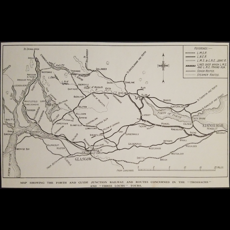
1929 Forth And Clyde Junction Railway Tourism Routes Scotland Sketch Map Print Clipping - London, Midland And Scottish Railway - London And North Eastern Railway - Ready For Framing
Couldn't load pickup availability
Vintage Original 1929 Forth And Clyde Junction Railway Tourism Routes Scotland Sketch Map Print Clipping - London, Midland And Scottish Railway - London And North Eastern Railway - Ready For Framing
Measures Approx. 7-7/8" Wide by 5" Tall
In Very Good Vintage Condition - Unmounted, Trimmed Edges, Toning Due To Age And History-Collectors Watermarked That Is Not On The Clipping.
This 1929 Sketch Map Print Clipping Illustrates The Forth And Clyde Junction Railway And Routes Concerned In The "Trossachs" And "Three Lochs" Tours, Published In 1929, Illustrates Key Rail, Coach, And Steamer Connections Across Central Scotland. The Map Details Services Operated By The London, Midland And Scottish Railway (L.M.S.R.), The London And North Eastern Railway (L.N.E.R.), And Joint Operations Between Them. It Highlights Tourist Routes Linking Glasgow, Edinburgh, Stirling, And Scenic Areas Including Loch Lomond, Loch Katrine, And The Trossachs. This Map Served As A Promotional And Navigational Tool For Travelers During The Interwar Period.
Product Photos Include A Logo Watermark And Possibly An Object For Scale / Photography Purposes Only. Also, Product Listings May Include Newspaper Images, Display Photos Or Short Video Clips Relevant To The Item Which Are Not Included In The Purchase. The Product Title Is For The Exact Item Available.
Share