
History-Collectors.com
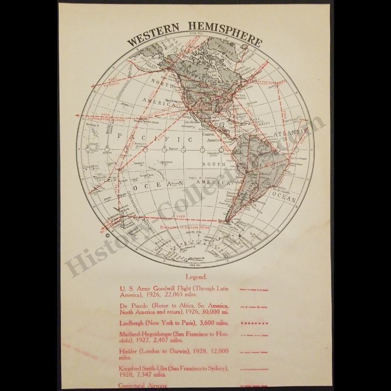
1929 Golden Age Of Flight Western Hemisphere Map - U.S. Army Goodwill Flight - De Pinedo - Lindbergh - Maitland-Hegenberger - Hinkler - Conjectural Airways - Roaring Twenties Era - Ready For Framing
1929 Golden Age Of Flight Western Hemisphere Map - U.S. Army Goodwill Flight - De Pinedo - Lindbergh - Maitland-Hegenberger - Hinkler - Conjectural Airways - Roaring Twenties Era - Ready For Framing
Couldn't load pickup availability
Vintage Original 1929 Golden Age Of Flight Western Hemisphere Map - U.S. Army Goodwill Flight - De Pinedo - Lindbergh - Maitland-Hegenberger - Hinkler - Conjectural Airways - Roaring Twenties Era - Ready For Framing
This 1929 Western Hemisphere Aviation Map Documents The Formative Years Of Global Flight By Illustrating Significant Long-Distance Aerial Expeditions Between 1926 And 1928. The Cartographic Work Features Precise Great Circle Routes For The 1926 U.S. Army Goodwill Flight Through Latin America, Francesco De Pinedo’s 30,000-Mile Four-Continent Journey, And Charles Lindbergh’s 1927 Transatlantic Solo Flight To Paris. It Further Records The Maitland-Hegenberger Transpacific Flight To Hawaii And The 1928 Kingsford Smith-Ulm Crossing From San Francisco To Sydney. Utilizing An Azimuthal Projection To Highlight Conjectural Airways And Statute Mile Distances, This Historical Ephemera Represents The Rapid Advancement Of Intercontinental Navigation And The Cultural Impact Of The Golden Age Of Aviation Within The United States During The Late Interwar Period.
In Very Good Vintage Condition – Trimmed Edges, Staining, Toning Due To Age And History-Collectors Watermarked That Is Not On The Map. Measures Approx. 6-1/4" Wide by 8-3/4" Tall.
Product Photos Include A Watermark And Possibly An Object For Scale / Photography Purposes Only. Also, Product Listings May Include Newspaper Images, Display Photos Or Short Video Clips Relevant To The Item Which Are Not Included In The Purchase. The Product Title Is For The Exact Item Available.
Share