
History-Collectors.com
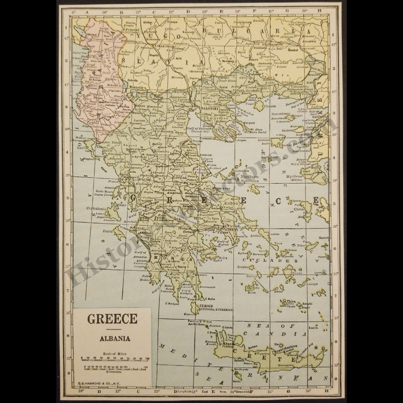
1929 Greece Albania Geography Map - C.S. Hammond And Company New York - Interwar Post-WWI Period - Roaring Twenties Era - Ready For Framing
1929 Greece Albania Geography Map - C.S. Hammond And Company New York - Interwar Post-WWI Period - Roaring Twenties Era - Ready For Framing
Couldn't load pickup availability
Vintage Original 1929 Greece Albania Geography Map - C.S. Hammond And Company New York - Interwar Post-WWI Period - Roaring Twenties Era - Ready For Framing
This Is An Authentic 1929 Political Map Of Greece And Albania Published By C.S. Hammond & Co. In New York. The Document Details The Post-World War I Geopolitical Landscape Of The Balkan Peninsula, Featuring The Newly Formed Kingdom Of Yugoslavia To The North And The International Boundaries Established Prior To The Second World War. Key Cartographic Elements Include The Delineation Of The Peloponnese As Morea, The Inclusion Of Crete With Historic City Nomenclature Such As Megalokastron, And The Presence Of The Italian-Occupied Dodecanese Islands. Produced During The Greek Second Republic, This Archival Map Serves As A Significant Record Of Interwar Territorial Borders, Regional Toponymy, And Early 20th-Century American Commercial Mapping Standards.
In Very Good Vintage Condition – Trimmed Edges, Toning Due To Age And History-Collectors Watermarked That Is Not On The Map. Measures Approx. 5-1/8" Wide by 7-1/8" Tall.
Product Photos Include A Watermark And Possibly An Object For Scale / Photography Purposes Only. Also, Product Listings May Include Newspaper Images, Display Photos Or Short Video Clips Relevant To The Item Which Are Not Included In The Purchase. The Product Title Is For The Exact Item Available.
Share