
History-Collectors.com
1929 Michigan Upper Peninsula U.P. Map - Maritime Trade - Industrial Railroad Routes - Roaring Twenties Era - Ready For Framing
1929 Michigan Upper Peninsula U.P. Map - Maritime Trade - Industrial Railroad Routes - Roaring Twenties Era - Ready For Framing
Couldn't load pickup availability
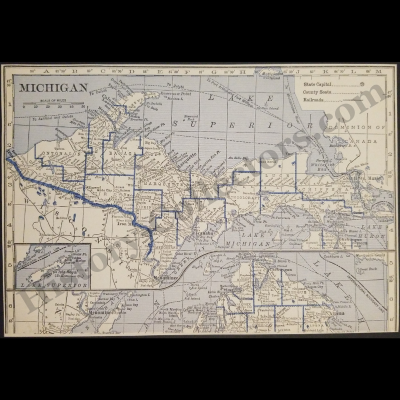
Vintage Original 1929 Michigan Upper Peninsula U.P. Map - Maritime Trade - Industrial Railroad Routes - Roaring Twenties Era - Ready For Framing
This 1929 Cartographic Map Of The Michigan Upper Peninsula Represents A Pivotal Document Of The Interwar Era, Illustrating The Region's Transition From A Frontier Resource Extraction Hub To An Integrated Industrial Landscape. Published During The Peak Of The Great Lakes Maritime Trade Expansion, This Primary Source Features Detailed Railroad Networks Essential To The Copper And Iron Mining Sectors Of The Keweenaw Peninsula And Marquette Range. The Document Catalogues County Boundaries Including Ontonagon, Baraga, And Marquette, While Providing Precise Toponymic Data For Ghost Towns And Early Logging Settlements. This Specific Geographic Rendering Predates The Federal Establishment Of Isle Royale National Park, Depicting The Island As A Jurisdictional Extension Of Keweenaw County. As A Significant Example Of Twentieth-Century American Ephemera, The Map Serves As An Archival Record Of Early Transportation Infrastructure, Great Lakes Shipping Routes, And The Public Land Survey System Used For Regional Development Prior To The Great Depression.
In Very Good Vintage Condition – Trimmed Edges, Toning Due To Age And History-Collectors Watermarked That Is Not On The Map. Measures Approx. 8-1/8" Wide by 5-1/2" Tall.
Product Photos Include A Watermark And Possibly An Object For Scale / Photography Purposes Only. Also, Product Listings May Include Newspaper Images, Display Photos Or Short Video Clips Relevant To The Item Which Are Not Included In The Purchase. The Product Title Is For The Exact Item Available.
Share