
History-Collectors.com
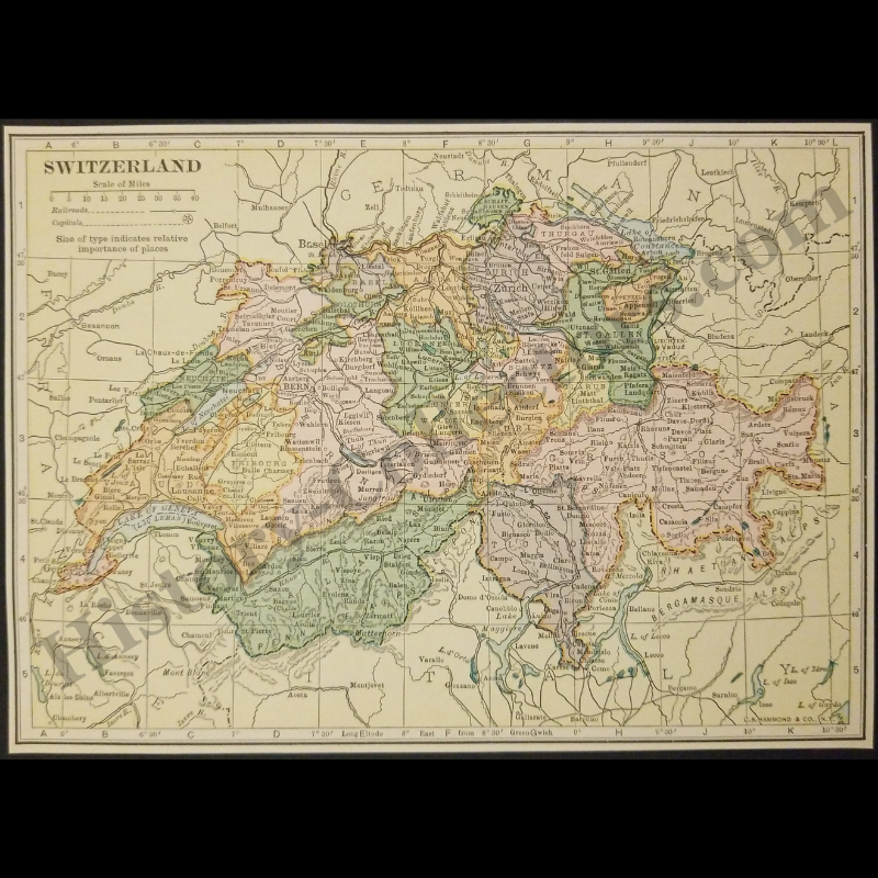
1929 Switzerland Geography Map - C.S. Hammond And Company New York - Interwar Post-WWI Period - Roaring Twenties Era - Ready For Framing
1929 Switzerland Geography Map - C.S. Hammond And Company New York - Interwar Post-WWI Period - Roaring Twenties Era - Ready For Framing
Couldn't load pickup availability
Vintage Original 1929 Switzerland Geography Map - C.S. Hammond And Company New York - Interwar Post-WWI Period - Roaring Twenties Era - Ready For Framing
This 1929 Map Of Switzerland Represents A Pivotal Historical Document Produced By C.S. Hammond & Co. During The Interwar Period. The Geographic Data Depicts The Twenty-Five Individual Cantons Of The Swiss Confederation With Accurate Territorial Borders As They Existed Ninety-Seven Years Ago. In 1929, Switzerland Maintained Rigid Political Neutrality Under The League Of Nations Headquartered In Geneva, While Simultaneously Expanding Its Trans-Alpine Railway Infrastructure Across The Bernese Oberland And Grisons Regions. The Cartography Highlights Critical Topographical Landmarks Including The Matterhorn, Lake Constance, And Lake Geneva, Which Served As Essential Border Markers Between Germany, France, Italy, And Austria. As A Primary Source From New York-Based Cartographers, The Document Recorded The Geopolitical Stability Of Central Europe Just Prior To The Global Economic Shift Of Late 1929.
In Very Good Vintage Condition – Trimmed Edges, Toning Due To Age And History-Collectors Watermarked That Is Not On The Map. Measures Approx. 7-1/8" Wide by 5-1/8" Tall.
Product Photos Include A Watermark And Possibly An Object For Scale / Photography Purposes Only. Also, Product Listings May Include Newspaper Images, Display Photos Or Short Video Clips Relevant To The Item Which Are Not Included In The Purchase. The Product Title Is For The Exact Item Available.
Share