
History-Collectors.com
1929 United States Panama Canal Zone Map - Engineering Landmarks - Roaring Twenties Era - Ready For Framing
1929 United States Panama Canal Zone Map - Engineering Landmarks - Roaring Twenties Era - Ready For Framing
Couldn't load pickup availability
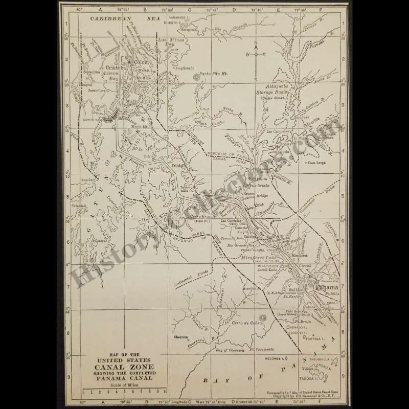
Vintage Original 1929 United States Panama Canal Zone Map - Engineering Landmarks - Roaring Twenties Era - Ready For Framing
This 1929 C.S. Hammond & Company Map Documents The Completed Panama Canal And The United States Canal Zone During The Interwar Period. This Cartographic Record Features Critical Engineering Landmarks Including The Gatun Dam, The Gaillard Cut, And The Miraflores Locks Alongside The Delineated Five-Mile Jurisdictional Boundary. It Captures A Significant Transition Point In Isthmian History, Specifically Noting The Alhajuela Storage Basin Under Construction To Regulate Water Levels For The Panama Railroad And Trans-Isthmian Transit. As A Primary Source Of Early Twentieth-Century American Expansionism, This Map Preserves The Toponymy Of Submerged Settlements And Military Administrative Sites Within The Ten-Mile Wide Sovereign Territory Managed By The United States Government From 1903 To 1979.
In Very Good Vintage Condition – Trimmed Edges, Toning Due To Age And History-Collectors Watermarked That Is Not On The Map. Measures Approx. 5" Wide by 7" Tall.
Product Photos Include A Watermark And Possibly An Object For Scale / Photography Purposes Only. Also, Product Listings May Include Newspaper Images, Display Photos Or Short Video Clips Relevant To The Item Which Are Not Included In The Purchase. The Product Title Is For The Exact Item Available.
Share