History-Collectors.com
c1950 Rhine River Region Illustrated Relief Map Clipping - West Germany - Post WWII Reconstruction
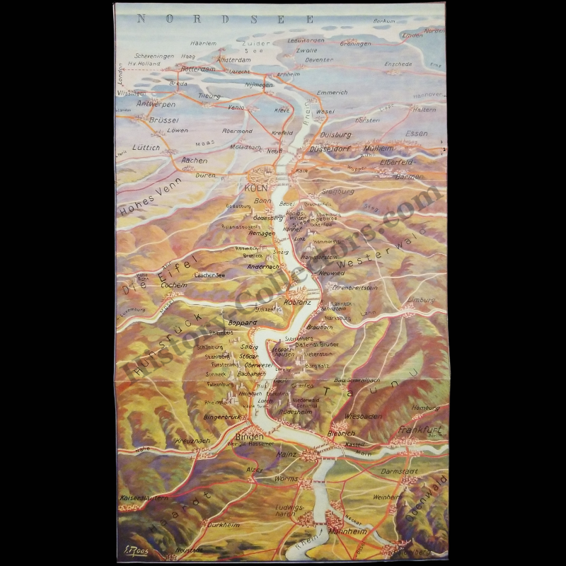
c1950 Rhine River Region Illustrated Relief Map Clipping - West Germany - Post WWII Reconstruction
Couldn't load pickup availability
Vintage Original c1950 Rhine River Region Illustrated Relief Map Clipping - West Germany - Post WWII Reconstruction
Unfolded Measures Approx. 7-1/8" Wide by 12" Tall
In Very Good Vintage Condition - Bi-Fold, Toning Due To Age And History-Collectors Watermarked That Is Not On The Map.
This Illustrated Relief Map Depicts The Rhine River Region Between Cologne And Mannheim, Highlighting Cities, Castles, And Geographic Features Such As The Eifel, Hunsrück, Westerwald, And Taunus. Created By S. Roos, The Map Emphasizes The Middle Rhine Valley, A Region Known For Its Historical Significance In Trade, Culture, And Military Strategy. This Map Reflects The Historical Importance Of The Rhine As A Central European Transport And Cultural Corridor.
Product Photos Include A Watermark And Possibly An Object For Scale / Photography Purposes Only. Also, Product Listings May Include Newspaper Images, Display Photos Or Short Video Clips Relevant To The Item Which Are Not Included In The Purchase. The Product Title Is For The Exact Item Available.
Share